We woke up to a new cold and beautiful morning at 35 F. The sun rose while we were having breakfast in anticipation of another clear and beautiful day.
Today, we plan to take just a few shots of the Intrepid Potash evaporation ponds and head out toward Bryce Canyon. We won’t be at Bryce today. We’ll try to find a camping spot somewhere nearby.
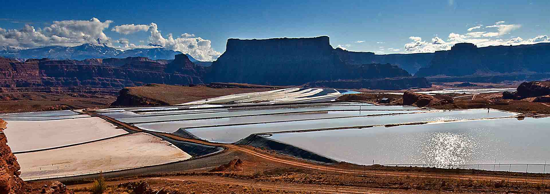
The photo below was taken on the way out of the nature sanctuary that hosted us for two days and two nights.
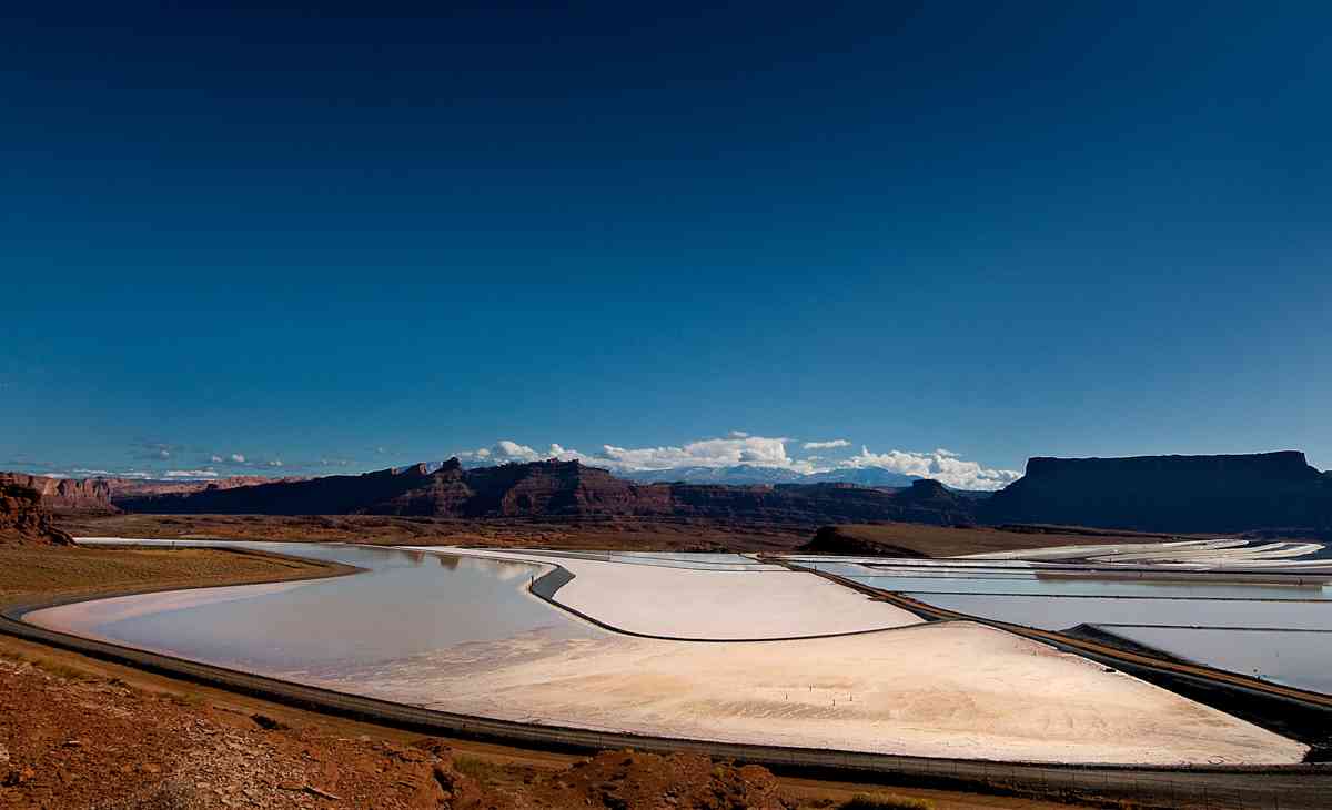
On our right, we see the cascading evaporation ponds of the vast potash industry.

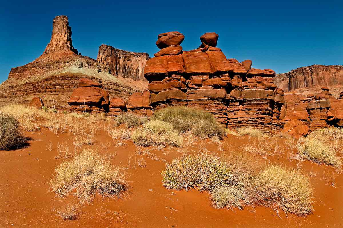
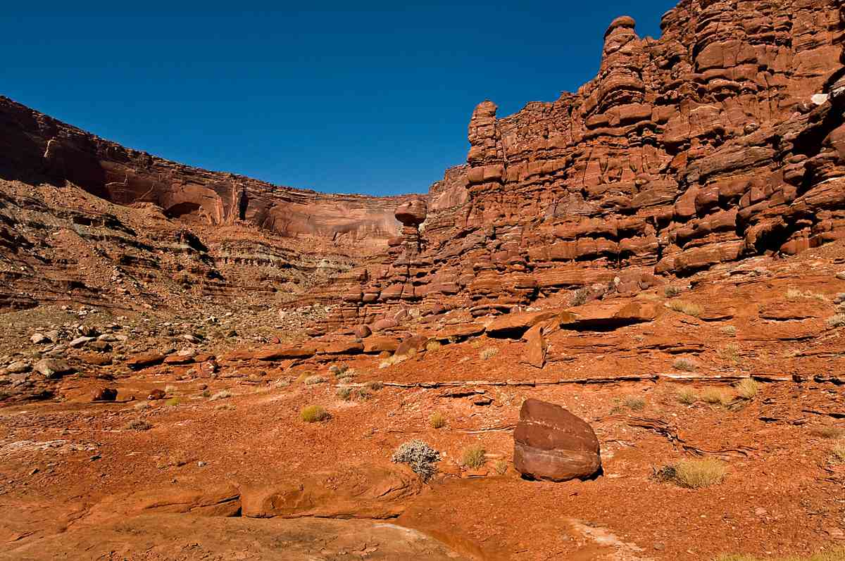
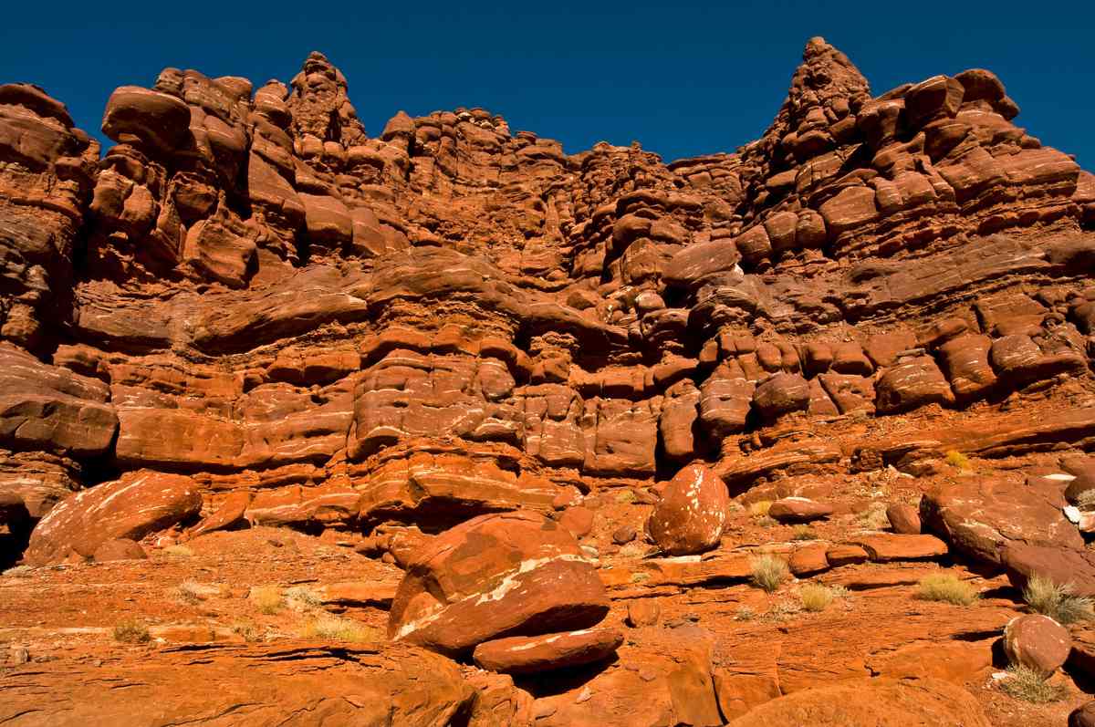
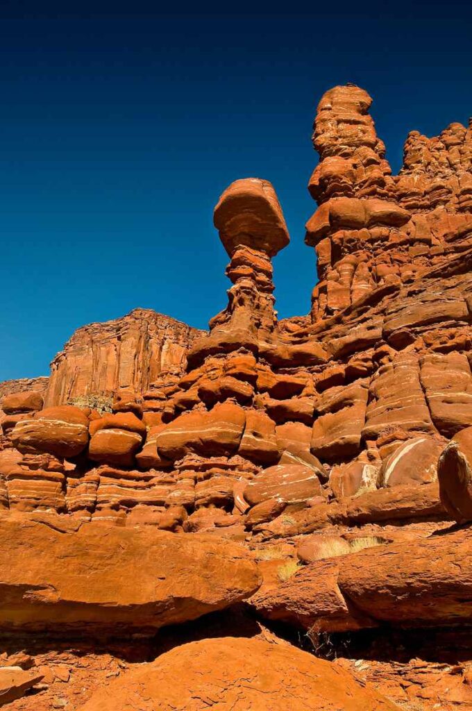
Before leaving this majestic canyon we stopped to take some more photos of the vertical sandstone formations. What can be a better excuse to linger in this magnetic place?
Off we go back on the veering gravel roads. We are leaving Dead Horse Canyon with great plans to cross Escalante National Monument on the way to Bryce Canyon. Or is it really a canyon? We will find out when we get there.
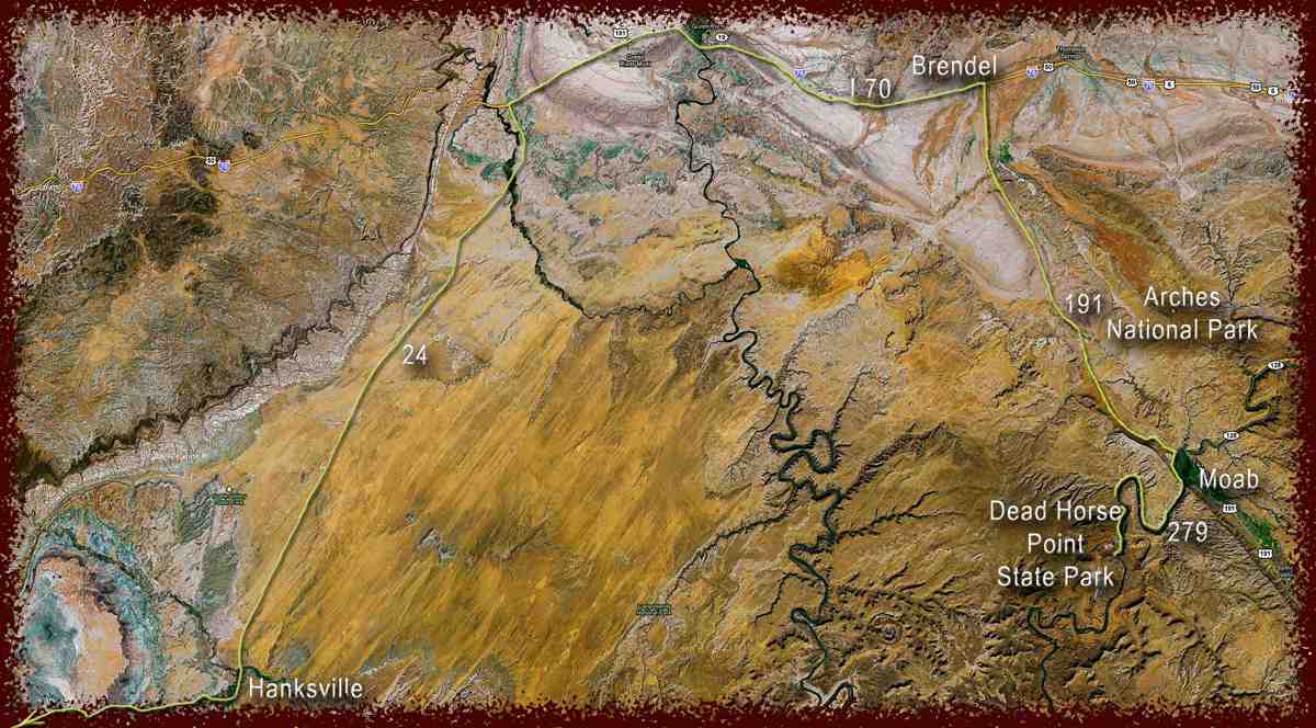
We went back on highway 279 toward Moab. It was a very warm and sunny day at 55 F. We pulled over for a swim in the numbingly cold and fast Colorado River. Refreshed and invigorated by the turbid and freezing waters, we returned to the minivan and continued on to highway 191 until reaching I-70.
From here we continued westward for about 33 miles to Brendel. At the Brendel exit, we drove south on highway 24. At the end of highway 24, we pulled over in Hanksville to get gas. We met a very pleasant couple from Germany touring cross country on a rental RV. They pulled over to buy some hot coffee at the gas station. When we stepped out of the convenience store, we saw the couple standing in front of our minivan and laughing at our cat lounging in the morning sun rays on the dashboard. Returning from Bryce Canyon, they highly recommended we go there and enjoy its immense beauty.
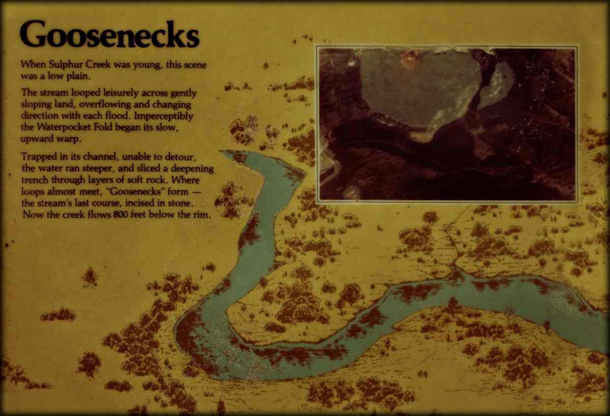
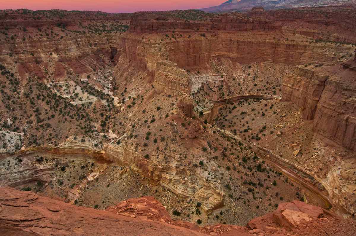
Without further delay in exciting anticipation of our future adventures, we continued westward on highway 24. The scenery was gorgeous, and we had to pull over to Capitol Reef National Park to take a quick look at the Utah version of the Goosenecks.
The Goosenecks here are not nearly as deep as those found near Mexican Hat, Utah but still quite impressive. The colors of the minerals changed from deep orange-red in the Canyonlands to pastel-peachy in Capitol Reefs and Glen Canyon National Recreation Area.
After a short stop at Goosenecks, we continued west through Dixie National Forest. In need of a camp spot at the end of the day, we nestled in a quiet area in Grand Staircase – Escalante National Monument just about one mile off highway 12 between Escalante and Henrieville. We enjoyed this picturesque trip and will set camp for two nights at this location. The nighttime temperature will be 30 degrees, cold enough to cover our water supply with a layer of ice by morning. But cold weather never presented a problem for us so far. Only more restful nights.